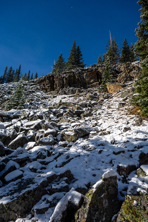
After gaining the ridge from the road, and hiking through the forest we enter the edge of a boulder field.
We didn't take the route in Nugara's book, not wanted to cross the Livingstone River. On the map there logging road which starts in the NE side of the peak and continues to the west. A track had been logged from a spur of this road up the NE ridge of the peak which we decided to try. The regular route is very similar going up the SE ridge.
The route worked out fine with open forest, some willows (especially at the beginning), and some deadfall and a bit steep, but nothing you couldn't handle in the fresh snow we had.
This wasn't my first choice this weekend, but with poor weather, commitments to dinners, and fresh snow it was the best I could think of to do. This area has been opened up to coal mining exploration, and Vicary Creek Ridge already has access issues, so I was somewhat keen to do this one before that became a problem here too.